
 Printer Friendly
 Email to a Friend
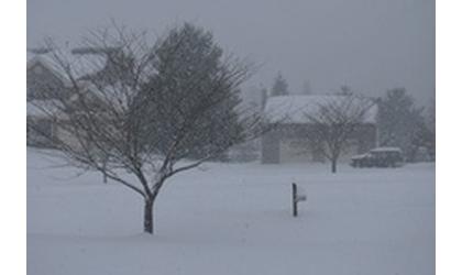
(KLZA)-- A winter weather advisory is in effect from 3:00 A.M. Thursday to midnight Thursday night for central and southeast Nebraska and eastward into southwest Iowa.
The National Weather Service predicts mixed precipitation with total snow accumulations of up to 2 inches and ice accumulations of one-tenth to two-tenths of an inch.
The ice will result in difficult travel conditions and travel delays. There could also be reduced visibilities at times.
Snow should mix with or change to light freezing drizzle Thursday morning for all but far northeast Nebraska. Precipitation should lighten up around midday, then another round of light snow and freezing drizzle is expected Thursday afternoon and Thursday evening ending from west to east.
© Many Signals Communications
MOST VIEWED STORIES
Holton man receives Hard 25 sentence for child sex crime
Horton man arrested following weekend shooting
Hiawatha man facing sex, drug charges waives prelim hearing
Two arrested Thursday in Jackson Co on meth-related charges
Power outage leads to early school dismissal
Inmate dies at Lansing Correctional Facility
Vacancy filled on USD 115 board
MO grass fire battled Thursday
Community Healthcare System hires new CEO
Mound City Mayor Duane Nauman remembered
Falls City School Board approves personnel moves and purchases
Valley Falls' future set for Wednesday eve discussion
PBPN breaks ground for new business
Sheriff issues safety reminder
Brown Co Planning Commission established
USD 415 board approves bids for new HS stadium lights
Johnson-Brock School not able to accept all option-in requests
RELATED STORIES
Winter Storm Leads to Large Increase in MO Traffic Crashes
Freezing Rain Advisory Issued for NW Missouri, NE Kansas
More Snow Possible Early Next Week
MoDOT Warning Drivers to Stay Home
Winter Storm Expected to Affect Northern Missouri
Weather May Disrupt New Year's Travel Plans


Hiawatha, Ks 66434