
 Printer Friendly
 Email to a Friend
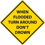
(MSC News)--Heavy rainfall, combined with warmer temperatures and melting snow, frozen ground and thick ice cover in rivers is creating the possibility of widespread flooding on area rivers and streams beginning Wednesday.
The National Weather Service says some locations along the Missouri River could see major flooding in the next week.
The warmer temperatures will accompany a strong storm system which is likely to produce 1 to 3 inches of rain in the next several days.
Due to the threat, flood warnings are put in place across the region, impacting local area communities of Nebraska, Kansas, and Missouri.
© Many Signals Communications
MOST VIEWED STORIES
Holton man killed in Jackson Co crash
Morrill pair arrested on drug, child endangerment charges
Falls City man sentenced to Federal Prison
Ground Broken for new Sac and Fox Trad'n Post
Horton City Clerk's resignation accepted Monday
Local residents avoid injury in chain reaction crash
Effingham owner regains truck following theft, arrest
Jackson Co traffic stop leads to arrest
Cold case investigation leads to Holton warrant
One held for past Atchison shooting
90 mph+ downburst winds blamed for Thursday damage
Wamego man sentenced in second fentanyl-related death
Mayetta pair arrested on meth, child endangerment charges
Stolen trailer, 4-wheeler, recovered in Atchison
Early Thursday storms leave damage, outages, locally
Juveniles face charges following Atchison break-in
Atchison Co's Oswald named honorary bailiff for KS Court
LATEST STORIES
Pawnee City School Board approves personnel changes
Hazard mitigation planning meeting set for Atchison County MO
Effingham owner regains truck following theft, arrest
Cold case investigation leads to Holton warrant
Senator Slama on tax relief efforts
SE Nebraska March unemployment report
Falls City Career Academy to open during 24-25 school year
Denim Day declared for Nebraska state colleges


Hiawatha, Ks 66434