
(KAIR)--Preparations are underway for the winter storm approaching the local area, with state transportation officials reminding motorists to be ready for the conditions.
That comes as current weather forecasts show bitterly cold temperatures and several inches of snow expected across the state starting Friday morning and extending into Sunday.
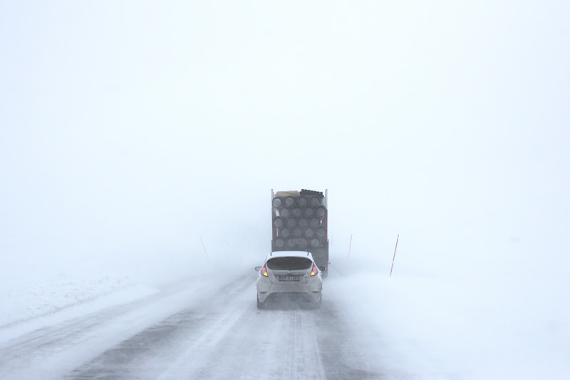
The Kansas Department of Transportation encourages the public to limit travel because these conditions can be dangerous for motorists as well as cause issues for highway workers who are working to clear the roads.
“We urge the public to limit travel for the safety of both motorists and our workers,” said KDOT Emergency Management Coordinator Jim Frye. “If you must travel, be prepared. Check KanDrive.gov for current road conditions before you leave. It’s maintained 24/7 and offers real-time camera views so you can see the road conditions for yourself.”
MSC Radio Network Chief Meteorologist Bill Spencer echoes that danger faced by travelers.
According to KDOT, the expected extremely low temperatures means dry snow will likely blow across the highways, as wind gusts reach up to 30 mph. Another problem is that in such extreme cold, the effectiveness of salt brine and granular salts is significantly diminished, and any melting that does occur may refreeze into ice within minutes, with both KDOT and Spencer expressing the importance of proper preparation is one does need to travel: inspect the vehicle; inspect fluid levels and tire pressures, and maintain a half tank of gas.
KDOT reminds motorists that frostbite can occur rapidly in these temperatures. Motorists are advised to stock an emergency kit in the vehicle before traveling.
Snow amount predictions vary by area in northeast Kansas, with Bill saying the Atchison and Jackson County areas could see between 6 to 8 inches from the time the snow starts Friday night and ends Saturday.
In a separate release also issued Thursday, neighboring Missouri sent a similar warning, with the Department of Transportation urging Missourians to plan ahead and avoid unnecessary travel because of the winter storm.
According to the National Weather Service, significant snowfall is expected across southern and central parts of the state beginning Friday evening, with the heaviest accumulation expected south of the I-70 corridor. Snowfall could last throughout Saturday and Sunday, and the National Weather Service warns of travel becoming “very difficult to impossible” throughout the storm in heavily impacted areas.
MoDOT activated its statewide winter weather response on Wednesday and will have crews fully deployed throughout the event. Drivers and plows are ready, and resources — including equipment and personnel — will be shifted to the hardest-hit areas. The extreme cold temperatures and heavy snow expected with this storm will limit the effectiveness of road treatments, so snowplows will need plenty of room to work to clear impacted routes.
“Our crews and equipment are ready, and we’ll be working around the clock to keep roads as clear as possible,” said MoDOT Director Ed Hassinger. “But we can’t do it alone. We need the public’s help. Please plan ahead. Once snow starts falling, stay put and give our crews time to work. Conditions will be challenging, and your cooperation is critical to keeping everyone safe.”
MoDOT encourages drivers to use the Traveler Information Map, available at traveler.modot.org and as a mobile app, to check real-time road conditions. For more information and updates throughout the storm, follow MoDOT on social media or visit modot.org.
