
 Printer Friendly
 Email to a Friend
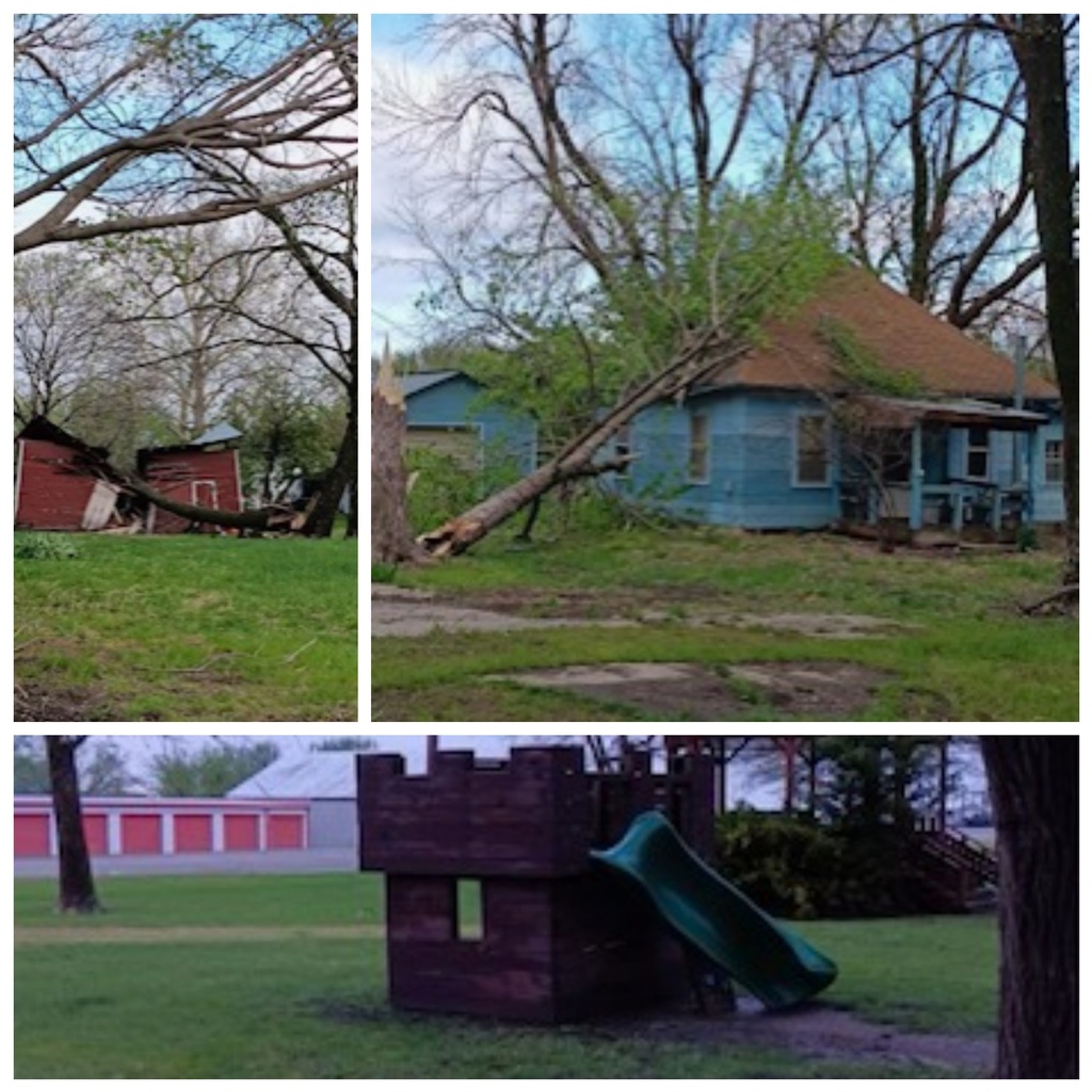
Photos submitted by Kate Johnson from Nortonville
(KAIR)--Thunderstorm downburst winds reaching up to 100 mph are blamed for this week's damage following severe thunderstorms that ripped through the area early Thursday morning.
Areas of Jefferson County were heavily impacted, with the County Emergency Management Office reporting that Nortonville and Valley Falls were hit the hardest, with roofs torn off, outbuildings destroyed, trees uprooted, and power lines knocked out.
Nortonville residents, sharing photos and videos of the storm's aftermath with MSC News have also expressed shock at how, in Nortonville for example, one part of the community could incur such damage, while just blocks away, signs that a storm had even occurred were minimal.
Storm damage assessments have been made, with Chad Omitt, Warning Coordination Meteorologist for the National Weather Service in Topeka, telling MSC News there were "numerous pockets of enhanced damage due to thunderstorm downburst winds." He estimates that winds in Jefferson County reached 70 to 90 mph, along with possible isolated higher gusts.
According to Omitt, the strongest of the winds during the local Thursday morning storms are estimated to have reached 80 to 100 mph on the south side of St. Marys, in Pottawatomie County, where damage was also incurred.
The storms rolled through the area sometime after 2:00 Thursday morning.
Omitt, in Friday's emailed correspondence with MSC News, explained that thunderstorm winds, or downdrafts, are also known as downbursts, and, or, microbursts, depending on how large an area is impacted.
© Many Signals Communications
MOST VIEWED STORIES
Updated: Mayetta woman now accused of attempted murder
Nortonville teen caught speeding more than 100 mph
Four arrested after Doniphan Co search warrants
Atchison man facing drug-related charges in Jackson Co
Mid-week wreck injures three in Atchison Co
One killed, 3 injured in NW MO crash
Atchison man accused of threatening woman with knife
Longtime Sabetha Fire Chief recognized for service
Mayetta woman facing firearms, drug-related charges
Extension district proposal fails to gain approval
St. Joseph Mo man injured after boat explodes
Man indicted for alleged assault on tribal land
Flags to fly at half-staff in honor of fallen deputy
Big Beautiful Bill discussed at Humboldt Town Hall meeting
Nominees sought to fill local judicial seat
Text scams involving KDOT continue
Protect yourself from West Nile Virus
New firm to do facilities assessment for USD 415
Culvert replacement project discussed at county meeting
Purchase of 2 patrol units for Richardson Co Sheriff's Office approved
LATEST STORIES
Four arrested after Doniphan Co search warrants
Text scams involving KDOT continue
Mid-week wreck injures three in Atchison Co
Mill Creek bridge in Holt County MO reopens
Atchison man accused of threatening woman with knife
Nortonville teen caught speeding more than 100 mph
Culvert replacement project discussed at county meeting


Hiawatha, Ks 66434